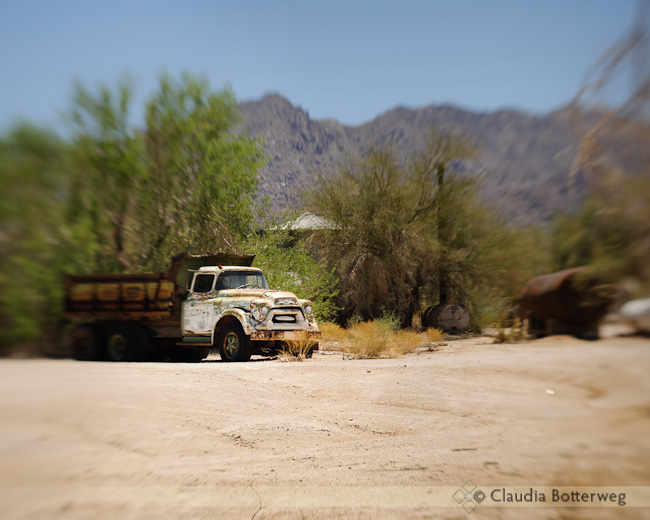
Desert Center Dump Truck
After sleeping in, I cruized through Ohio and got to Mom & Charlie’s place in Point Place, a small penisula that’s a suburb of Toledo. The top tip of the peninsula is in Michigan, which doesn’t make much sense to me. They live one house away from the Ottowa River in a beautiful old neighborhood.
Note: the roads in Ohio are full of potholes, there are lots of construction zones on I-75, all the rest areas are closed, and traffic is heavy. No wonder I stayed off the freeways for 1700 miles!
Ben & Jason came over for dinner. I haven’t seen Ben for almost two years and he’s turned into a full-grown man. Good looking, polite, helpful, industrious. Love him!
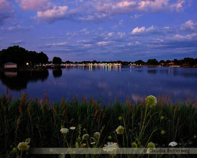
Today is a full moon. Ben and I went to find a clear spot to catch the moonrise. Dense clouds were on the horizon so I didn’t catch it till it was way above the trees. My tripod is good, but I’m using a [amazon:B000JLK5PK:inline] (which is a good ball head!), and the plate is loose. So the camera wasn’t steady for the moon shots, but I did figure it out by the time my attention was drawn to the house light reflections on the river. We were standing on the shoulder of Summit Street, with lots of traffic behind us. People probably thought we were crazy… It’s so good to be home!

After visiting the Butler Cemetary, I made my way to Lafayette (pronounced La-FAY-ette), where Beverly served me some dinner in her beautiful restored home. I told her about getting lost and watching [amazon B001EBV0LW inline] just a week ago. And Beverly said that it’s true, you need to be careful back in Reese Holler because we don’t know all these new people that others sold their land to, and there are marijuana plantations in some of the hollers. (So I was right to be nervous…)
I left Beverly’s at 9pm and made my way over to I-65. Coming out of the restroom at a rest stop near Elizabethtown, a man asked me if I was traveling alone. (!?) Told him that HusBott was waiting for me in the car and got on out of there.
Now here’s where my day got incredibly bleak. I was getting pretty tired. This was the first time I didn’t make plans for a hotel. I saw a sign for hotels at the next exit, which turned out to be the Joe Prather Highway. I drove for about 23 minutes on a 2-lane curvy road with nowhere to turn around, no signs of civilization, and pitch black even with bright lights, until I finally came to a crossroads and could turn around. It turns out that if I’d gone another 5 minutes I would have found something in the suburbs of Fort Knox.
I got back on to I-65 and stopped in Shepherdsville for the night. Whew! And you wonder why people call me an airhead once in a while?
Today was a very long day, indeed! After spending the day at with Clifton and Shelby at their new house, I took off to the Waller hollow (pronounced holl-er). The drive in was just as I remembered it: curvy and forever with nothing but woods, except that the roads are paved better and there are more bridges over the creeks (pronounced branch).
I pulled up into Aunt Maude’s driveway. Now, Aunt Maude is in a nursing home, Uncle Hiram passed away several years ago, and all my cousins live in other places. The house was supposed to be empty, but there were 3 scruffy guys sitting on the front porch. Keeping my husband’s advice in mind (we watched [amazon B001EBV0LW inline] just before I left home), I walked up and said, “Hi, I’m a Waller…”. One of the guys stood up and said, “Well that’s good because I’m a Waller too!” It turned out to be my cousin Danny Joe, who was scruffy because they had been working all day on restoring the house so that visitors can come and stay whenever they want to. Beverly and Steve came by and we had a great time catching up after 30 years.
I took a pano of where my Great Grandma Hettie’s house used to be in the little valley (holler). Steve’s house is there now (Grandma’s house burned down a couple decades ago). Most everything looks the same except for trailers on lots on the hill around the bend.
On the way to Aunt Chloe’s, I stopped by Ollie’s but nobody was home. Aunt Chloe’s house burned down many years ago, and there is no trace that it ever existed. I couldn’t figure out where it might have been.
I wanted to go up to see my Mom’s cabin (sold long ago). There were 2 driveways that could have been correct, but one was fenced and locked and the other didn’t go very far. At the end of the road, I turned the wrong way and got lost on some sort of dead end road that went on and on, with lots of driveways that looked like roads and roads that looked like driveways. After an hour of driving back and forth, up and down, and around and around, and things starting to seem familiar, but starting to get a little dark, I managed to find a man in a Jeep, and later a kid on a bike, who told me how to get out of there. Whew! (Memories of Deliverance)

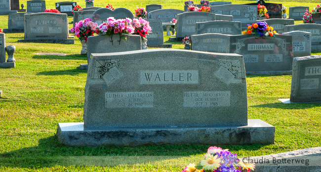
I never found Aunt Chloe’s church, but stopped by the Butler Cemetary where Luther and Hettie are buried. I marked it on the map below, but I doubt that is actually where it is…
From Paducah to Carthage is about 185 miles. I took a detour through the Land Between the Lakes National Recreation Area. After we get our RV, we will come back and stay awhile to explore this beautiful area.
When I got to Carthage I stopped to see my cousin Geneva, and got to see my cousin David who was visiting from Michigan. I’ll probably get to see him again while I’m in Ohio. Now off to cousin Clifton’s house, where I’ll be spending the night.
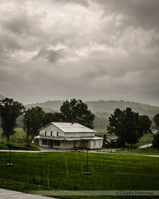
I should mention that though the skies were not clear, it didn’t rain on me all day until I got on the Defeated Creek road. Then I was inundated once again, and could barely see the road. I stopped at Aunt Maude’s church and took a picture of the old Kempville Store, where my Yankee cousins and I used to get our fashionable (and authentic!) denim overalls. The store has been closed for awhile. Back in the 70’s there would have been a few men on the porch, leaning back in their bark chairs.

Getting up early, I traveled down I-55 through a gut-clenching, hydroplane-causing, can’t-see-20-feet-in-front-of-you downpour for 30 minutes till I got to Ste. Genevieve, Missouri. Now Ste. Genevieve is a charming little town on the banks of the Mississippi river with a French heritage. I would have loved to get out of the car for a nice walk, but it was raining cats and dogs. I stopped in a lot next to the river and tried to watch a barge being filled by a grain elevator on the Illinois side, but this was the best I could do:

After driving all around Ste. Gevevieve, I traveled mostly on Route 61 down to Cape Girardeau. By the time I got there, the rain had turned into intermittent showers and gray skies. I stayed a good long time on the riverbank watching barges tug past, missing living in Memphis and thinking old thoughts.
I crossed the bridge to Illinois and stopped at a little park in Thebes before heading on to Cairo. Having listened to a podcast recently about Cairo, I have to admit that Bob was right. I have never seen so many decrepit, haunted-looking mansions in one place before. I should mention that I got lost before Cairo and had to stop to ask for directions.
Now, on to Route 60, over the Ohio River on a truly scary bridge, and on to Paducah, Kentucky. Had a great dinner and went downtown to watch the fireworks. I would like to come back to Paducah someday, it is full of very friendly people and has a great downtown.
Waiting for fireworks in Paducah, Kentucky.

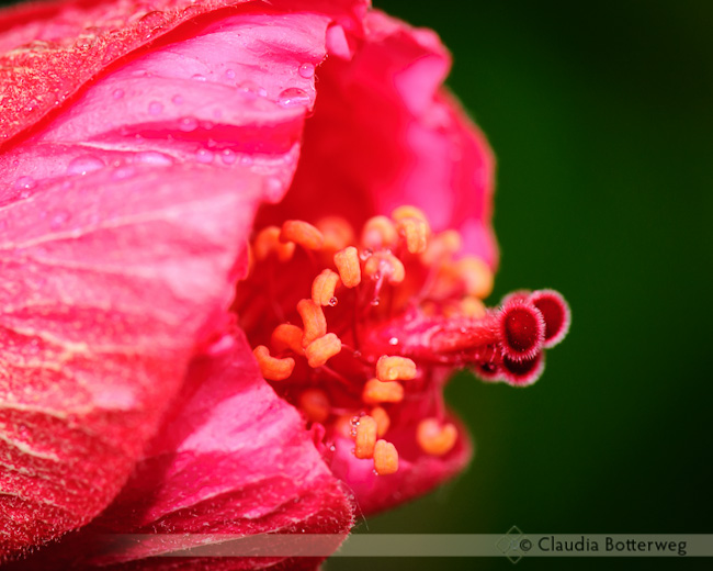
I left the hotel at 8am so that I could stop at Powell Gardens in Kingsville, MO. If you click on the link to the gardens, you’ll see that it’s a unique and beautiful public garden. As I pulled into the parking lot it started sprinkling. By the time I used the facilities and went through the visitor center, it was pouring. I lost all my umbrellas and rain coats over the 20 years I’ve been in Arizona! I didn’t go any further than these hibiscus on the patio of the visitor center.

From Kingsville, I drove all the way to Crystal City on the Mississippi River. I outran the rain and had mostly cloudy skies for the rest of the day. It was supposed to be about a 5 hour trip. but I got turned around in the construction and detours at the outerbelt at St. Louis. I had to stop at a big teepee to get directions.
Crystal City is a suburb of Festus. Nice little towns with beautiful old homes and charming neighborhood parks. And lots of hotels on the freeway.
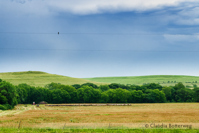
I got kind of a late start today and stopped by the Tallgrass Prairie National Preserve, which is an old ranch with a wonderfull stone mansion and barns. The interesting part about the preserve is its acres and acres of prairie. I managed to get this photo of harvested hay across the street from the preserve before it started raining.

I discovered that I left the rain covers for my camera bag and camera back in Phoenix, so I tried to make do with grocery bags. There was steady light rain so I stayed in the barn to get a few pictures of the prairie. I took a tour of the mansion instead of exploring the prairie.
I’m staying in Harrisonville, a small town south of Kansas City. Tomorrow I’ll go to Powell Gardens. I didn’t go very far today. I had planned to spend more time at the preserve.
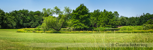
I only drove about 100 miles today, but took all day to do it. In the morning I went to the wonderful Dyck Arboretum in Hesston, Kansas. Here’s a pano of the lawn that surrounds the pond in the gardens. There is a great variety of prairie flowers and wetlands at the arboretum. I spent a while trying to get a picture of some stripey dragonflies near the creek, but they move too fast.

On the way from Hesston to Strong City, I got a little lost in Newton while looking for the turn to Route 50, and had to stop to ask for directions. I stopped to see the Cedar Point Dam Mill and the Clements Stone Arch Bridge but didn’t take any pictures.
After getting settled in at the charming Prairie Fire Inn, I drove down to Cottonwood Falls for dinner. There’s a wonderful little restaurant here called the Emma Chase Cafe. Since I was here on a Wednesday, I missed the weekly music jam, but I did stock up on some jelly for gifts for my mom and cousins.
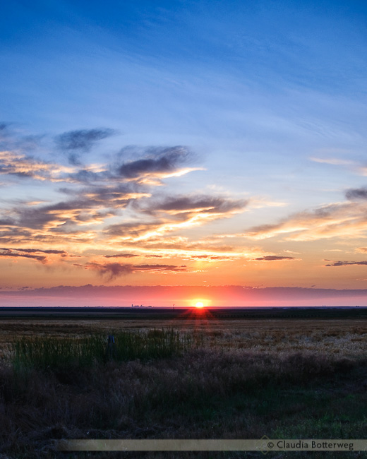
Woke up around 4am so that I could catch a sunrise from the heartlands.
Found my way to the Chalk Pyramids, then went on south to visit the Sandsage Bison Range. I made a left at Garden City and made my way to Hutchinson. I only drove about 250 miles today, but stopped so often to take photos that I got to Hutchinson around 4pm. After dinner I visited the Dillon Nature Center and had a nice walk around the lake.
I did not get lost today, woohoo!
After seeing Kansas from I-70 a few times, I am a bit shocked that Kansas is such a beautiful place! The rest areas along Route 50 are like parks, but with nice clean restrooms.